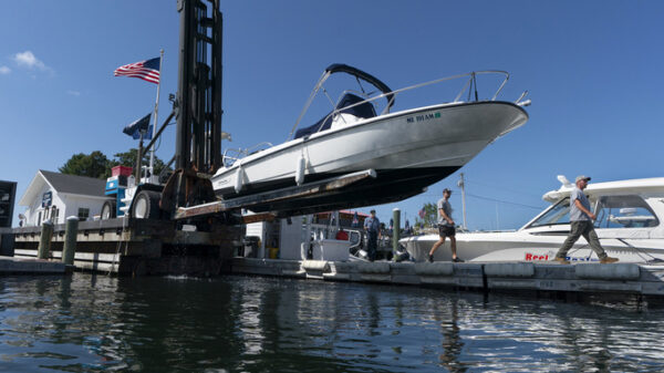
Michael Richard of Creole Cuisine Restaurant Concepts boards up Crescent City Pizza on Bourbon Street in the French Quarter before landfall of Hurricane Ida in New Orleans, Saturday, Aug. 28, 2021. Richard said the group is planning to board up and protect 34 restaurants owned by the company for the storm. (AP Photo/Matthew Hinton)
NEW ORLEANS (AP) — Weather forecasters warned residents along Louisiana’s coast to rush preparations Saturday in anticipation of an intensifying Hurricane Ida, which is expected to bring winds as high as 140 mph (225 kph) when it slams ashore on Sunday.
Authorities called a combination of voluntary and mandatory evacuations for cities and communities across the region. In New Orleans the mayor ordered a mandatory evacuation for areas outside the city’s levee system and a voluntary evacuation for residents inside the levee system. But since the storm quickly escalated in intensity, Mayor LaToya Cantrell said it was not possible to order a mandatory evacuation for the entire city, which would require using all lanes of some highways to leave the city.
Traffic was heavy on westbound routes out of town early Saturday and gas stations were busy.
The storm is expected to make landfall on the exact date Hurricane Katrina devastated a large swath of the Gulf Coast 16 years earlier. But whereas Katrina was a Category 3 when it made landfall southwest of New Orleans, Ida is expected to reach an extremely dangerous Category 4 hurricane, with top winds of 140 mph (225 kph) before making landfall likely west of New Orleans late Sunday.
“Today is it,” Jamie Rhome, acting deputy director of the U.S. National Hurricane Center in Miami, said Saturday. “If you’re in coastal Louisiana and Mississippi, you really, really have to get going because today is it in terms of protecting life and property.”
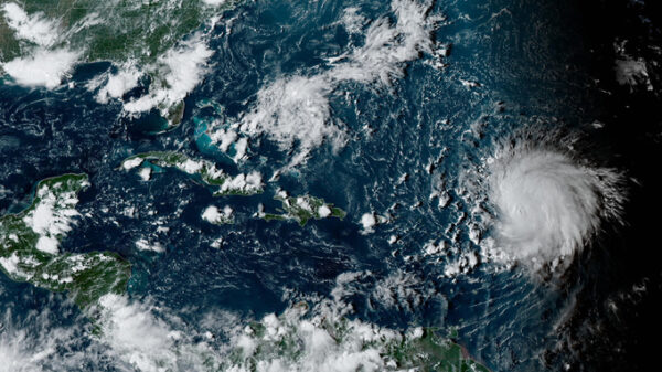
Ida intensified rapidly Friday from a tropical storm to a hurricane with top winds of 80 mph (128 kph) as it crossed western Cuba. It’s expected to pick up steam as it goes over the warm waters of the Gulf of Mexico.
On Saturday morning, Ida was centered 440 miles (710 kilometers) southeast of New Orleans. It was traveling northwest at 16 mph (26 kph), forecasters said. It’s maximum sustained winds had increased to 85 mph (140kph).
In New Orleans, city officials said residents need to be prepared for prolonged power outages, and asked elderly residents to consider evacuating. Collin Arnold, the city’s emergency management director, said the city could be under high winds for about ten hours. Earlier Friday, Cantrell called for a mandatory evacuation for residents outside the city’s levee protections — a relatively small sliver of the city’s population.
Ida would be the latest test of the New Orleans’ aging street drainage system. In a statement Friday, the city outlined steps it was taking to ensure that pumps were working and power sources to those pumps were ready. But, the amount of rain could be enough to overwhelm even a fully functional system.
“We want to be clear, that with the amount of rain now forecasted, approximately 10 inches over the course of the event, it is likely that we will experience flooding,” the city said in a late Friday statement.
Some ordinarily bustling businesses were closed Saturday. One popular breakfast spot was locked up tight with sandbags against the door to guard against flash floods.
With the storm’s forward speed slowing down and the intensity picking up, the storm surge may overtop some levees that protect parts of New Orleans on the west bank of the Mississippi River, said Heath Jones, emergency manager, of the Army Corps of Engineers’ New Orleans District. However he said they are designed to be overtopped and have protections in place to prevent more damage. There does not appear to be any danger of storm surge coming over the levees that protect the city’s east bank, which makes up most of the city, he said.
Across the region, residents were filling sandbags, getting gas for cars and generators and stocking up on food. Capt. Ross Eichorn, a fishing guide on the coast about 70 miles (112 kilometers) southwest of New Orleans, said he fears warm Gulf waters will “make a monster” out of Ida.
“With a direct hit, ain’t no telling what’s going to be left — if anything,” Eichorn said. He added: “Anybody that isn’t concerned has got something wrong with them.”
A hurricane warning was issued for most of the Louisiana coast from Intracoastal City to the mouth of the Pearl River. A tropical storm warning was extended to the Mississippi-Alabama line.
At the same time hospitals are preparing for the storm, they are still dealing with a fourth surge of the coronavirus. Officials decided against evacuating New Orleans hospitals. There’s little room for their patients elsewhere, with hospitals from Texas to Florida already packed with patients, said Dr. Jennifer Avengo, the city’s health director.
At the state’s largest hospital system, Ochsner Health System, officials ordered 10 days worth of fuel, food, drugs and other supplies and have backup fuel contracts for its generators. One positive was that the number of COVID-19 patients had dropped from 988 to 836 over the past week — a 15% decline.
President Joe Biden approved a federal emergency declaration for Louisiana ahead of the storm. White House press secretary Jen Psaki said FEMA plans to send nearly 150 medical personnel and almost 50 ambulances to the Gulf Coast to assist strained hospitals.
Ida made its first landfall Friday afternoon on Cuba’s southern Isle of Youth. The Cuban government issued a hurricane warning for its westernmost provinces, where forecasters said as much as 20 inches (50 centimeters) of rain could fall in places, possibly unleashing deadly flash floods and mudslides. Landfall in the U.S. is expected late Sunday in the Mississippi River delta region.
If that forecast holds true, Ida would hit 16 years to the day that Hurricane Katrina made landfall with 125 mph (201 kph) winds near the riverside community of Buras.
Katrina is blamed for an estimated 1,800 deaths from the central Louisiana coast to around the Mississippi-Alabama state line. A massive storm surge scoured the shores and wiped houses off the map. In New Orleans, failures of federal levees led to catastrophic flooding. Water covered 80% of the city and many homes were swamped to the rooftops. Some victims drowned in their attics. The Superdome and New Orleans Convention Center became scenes of sweltering misery as tens of thousands were stranded without power or running water.
Additionally, the hurricane center said a new tropical depression formed early Saturday. It was centered 820 miles (1,320 kilometers) east-southeast of the Leeward Islands. It was expected to remain over the open Atlantic Ocean and posed no hazards to land.
Copyright 2021 Associated Press. All rights reserved.


